Invest 95L, a Tropical Disturbance located in the southeast Bahamas has developed a low pressure center and is beginning to rotate, however it has not yet developed a closed circulation, but its development into Tropical Depression 9 is extremely likely.
Location: 23.7°N 74.8°W
Maximum Winds: 25 kt Gusts: nan kt
Minimum Central Pressure: 1008 mb
Environmental Pressure: 1012 mb
Radius of Circulation: 210 NM
Radius of Maximum Wind: 150 NM
- Satellite derived winds and surface observations indicate that the
disturbance in the Bahamas has not yet developed a closed
circulation, and that the winds are not strong at this time.
However, surface pressures remain low and environmental conditions
are favorable for a tropical depression or tropical storm to form
within the next day or two as the system moves toward the northwest
at 5 to 10 mph through the northwestern Bahamas and toward the
Florida Peninsula. Potential Tropical Cyclone advisories could be
needed later today or Friday, and interests in the central and
northwestern Bahamas as well as Florida should monitor the progress
of this disturbance. Regardless of development, this disturbance
will bring heavy rainfall and gusty winds to portions of the Bahamas
through Friday, including areas of the northwestern Bahamas affected
by Hurricane Dorian. An Air Force Reserve reconnaissance aircraft is
still scheduled to investigate the system this afternoon.
- Formation chance through 48 hours…high…70 percent.
- Formation chance through 5 days…high…80 percent.

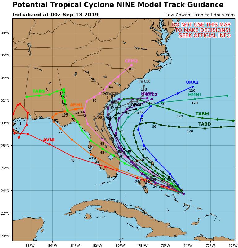
1200Z model runs.
Intensity forecasting is basically useless until the system develops a closed circulation, but I seriously doubt it will have more than Tropical Storm strength if/when it reaches Florida. This is more of a concern to the Bahamas, who obviously don’t need ANY tropical weather right now.
It will be more of a rain event for Florida than a wind event.